Permian Basin Products
Permian Basin Products
Easily explain your operations in the Permian Basin. We’ve developed very useful stock and custom Permian Basin graphics and animations for oil companies in the Permian Basin that illustrate the features of the Midland Basin, Central Basin and Delaware Basin.
![]()
Permian Basin Regional Illustration – M15
The Permian Basin Regional Schematic is a regional east-west cross-section of the Permian Basin covering the Delaware Basin, Central Uplift and Midland Basin. Stratigraphic layers include but not limited to San Andreas, Bone Spring, Spraberry, Wolfcamp, Cisco, Strawn, Morrow, Mississippian, Simpson Group and Ellenburger. Named for the Permian Period, the basin dates back 60 to 299 million years ago in geologic time. There are many differences in stratigraphic nomenclature across the greater Permian Basin. 100” x 34” @ 300 DPI.
Available for license
Permian Basin Cutaway Diagrams
Available for license
M16 - Delaware Basin
M17 - Central Basin Platform
M18 - Midland Basin
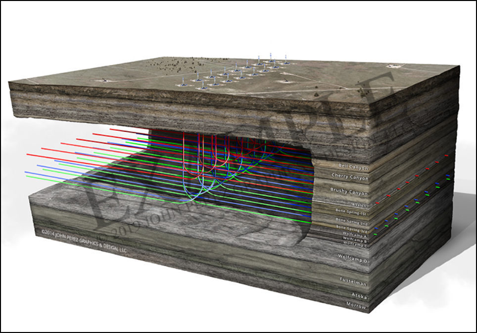
M19 - Delaware Basin Multi-Lateral Stacked Pay
M20 - Midland Basin
M22 - Multi-Lateral Schematic
HS5 - Midland Basin Cutaway Diagrams
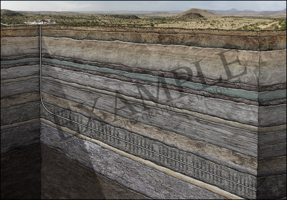
HS11 - Horizontal Drilling
JP886 - Vertical Well Sandstone
STR8 - Natural Gas Injection
STR9 - 5 Spot Waterflood Process
STR10 - CO2 EOR
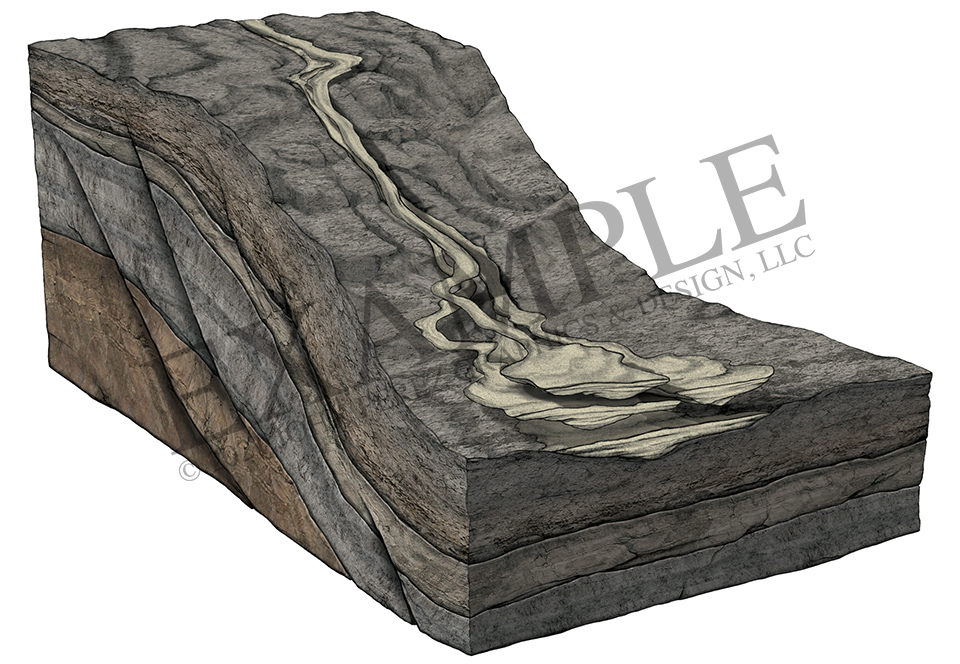
Deposition Illustration
Permian Basin Stock Educational Animations
Available for license
VT4 - CO2 EOR
– Enhanced Oil Recovery
– Oil becomes Miscible
– Tertiary Recovery
VT5 - Waterflood
– Secondary Recovery
– 5 Spot Pattern
– Cyclic Process
VT24 - Multi-Lateral Stacked Pay
– Stacked Laterals
– Horizontal Wellbores
– Hydraulic Fracing
VT72 - Permian Basin Geologic Animation
– Three-Dimensional View
– Stratigraphic Columns
– Stacked pay
![]()
![]()
Permian Basin Map – MP10
Stretching from southeastern New Mexico and covering most of West Texas, the Permian Basin covers 75,000 square miles—making it one of the larger basins in North America. The Permian Basin covers an area approximately 250 miles wide and 300 miles long and includes the Texas counties of Andrews, Borden, Crane, Dawson, Ector, Gaines, Glasscock, Howard, Loving, Martin, Midland, Pecos, Reeves, Terrell, Upton, Ward, and Winkler.
In 2018, the U.S. Geological Survey estimated that the Delaware Basin in West Texas and Southeastern New Mexico has the potential to produce 46.3 billion barrels of oil and the potential to produce 281 trillion cubic feet of natural gas.
Available for license